#{lake}
Explore tagged Tumblr posts
Text
Sweet Roses 🌹


#cottage#cottagecore#landsccape#farmcore#fairycore#aesthetic#indie#vintage#moon#full moon#moonlight#artwork#paradise#landscape#adventure#nature#explore#travelling#travel#sky#clouds#photography#art#drawing#lake#flowercore#flowers#photographers on tumblr#dark academia aesthetic#naturecore
17K notes
·
View notes
Text


Winter in Käxsundet. Värmland, Sweden (January 10, 2021).
333 notes
·
View notes
Text

Orion at Cowcowing Lakes, Western Australia
Nikon d810a - 50mm - ISO 3200 - f/2 Foreground: 8 x 20 seconds Sky: 20 x 25 seconds Ha: 8 x 60 seconds iOptron SkyTracker
#landscape astrophotography#astrophotography#night#sky#stars#space#Orion#nebula#astronomy#milky way#galaxy#astro#nightscape#airglow#Barnard's Loop#dead tree#lake#Cowcowing#Western Australia#outback#Australia#nikon#d810a#iOptron#SkyTracker
260 notes
·
View notes
Text

(by dbozz3)
#vertical#landscape#a#x#watsf#curators on tumblr#water#trees#mountain#dbozz3#lake#reflection#Lago Fedèra#Lago Federa#italy
213 notes
·
View notes
Text
This images brings peace 🕊️ to the soul


#moonlight#full moon#landsccape#moon#sky#clouds#stars#nightsky#lake#sundown#sunrise#artwork#landscape#photography#adventure#explore#travel#travelling#nature#paradise#indie#hipster#vintage#retro#aesthetic#photographers on tumblr#dark acadamia aesthetic#forestcore#cozycore#light academia
7K notes
·
View notes
Text


" Magical Sunrise ❄️🍁" // © Caroline Foster
#British Columbia#Canada#nature#landscape#Mountain#Winter#Snow#Lake#Forest#Trees#Sunrise#photography#aesthetics#wanderlust#explore#follow#discover
106 notes
·
View notes
Text
Greenwood cemetery, Brooklyn


12-21-2024, 4 PM
7K notes
·
View notes
Text

#pretty#beautiful#nature#clouds#sky#water#field#meadow#moodboard#landscape#cottagecore#aesthetic#ocean#lake#photography#places#art aesthetic#art#art nature#cloudscape#colorful#spring#sunrise#nature photography#icons#inspo#wallpaper#explore#view#sunset
71 notes
·
View notes
Text

Wild Burro Trail in Lake Pleasant Regional Park is a great place to see wild burros. The wild burros in Arizona are thought to be descendants of burros brought here back in the 1500s by Spanish explorers. the word "burro" comes from the Spanish word"borrico," which means donkey.
Prospectors used them for their sure footed hooves and strong backs. Many escaped or were set loose forming the herds that roam Arizona today.
72 notes
·
View notes
Text
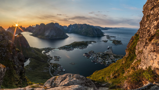
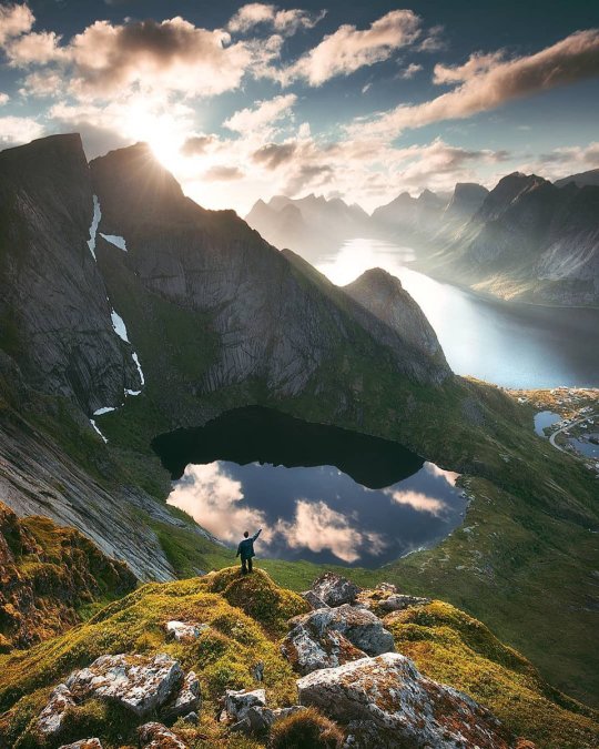
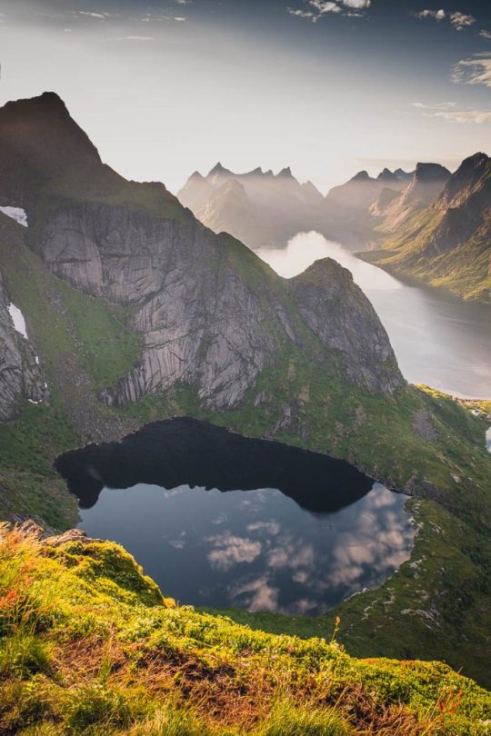
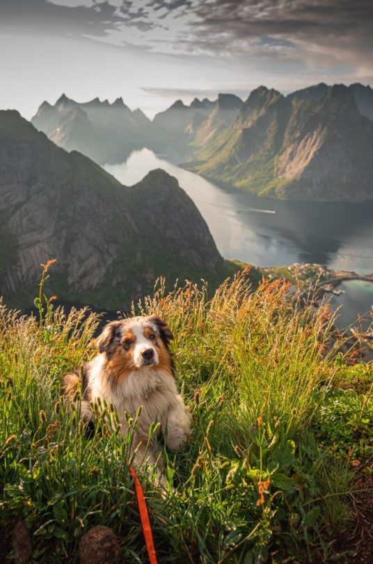
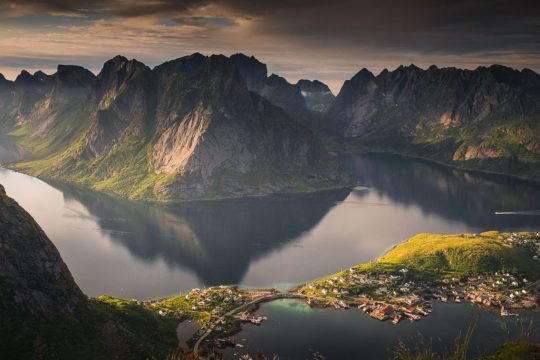
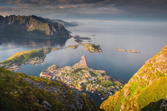
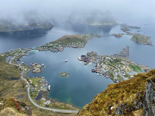
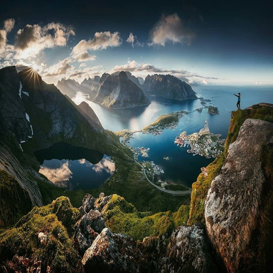
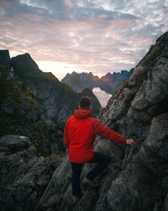
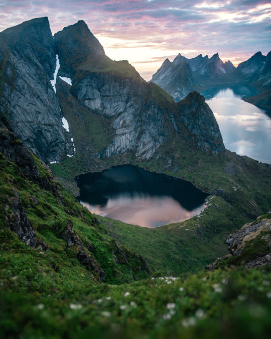
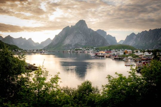
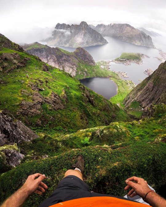
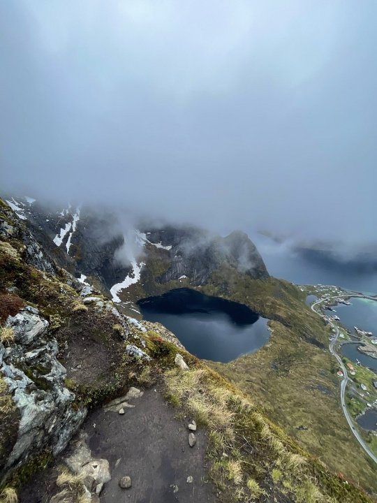
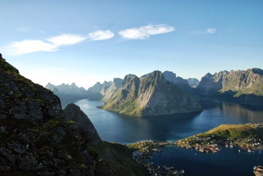

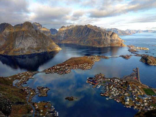
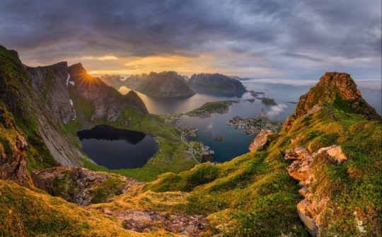
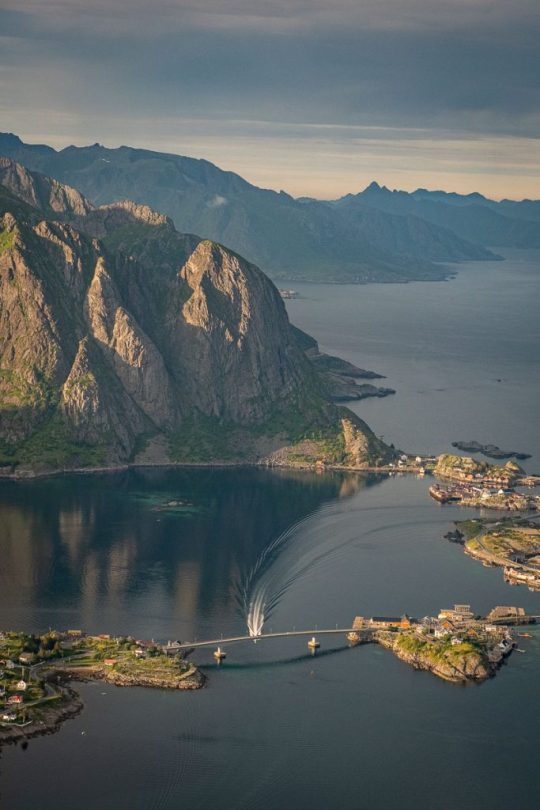
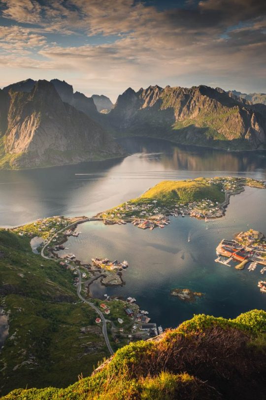
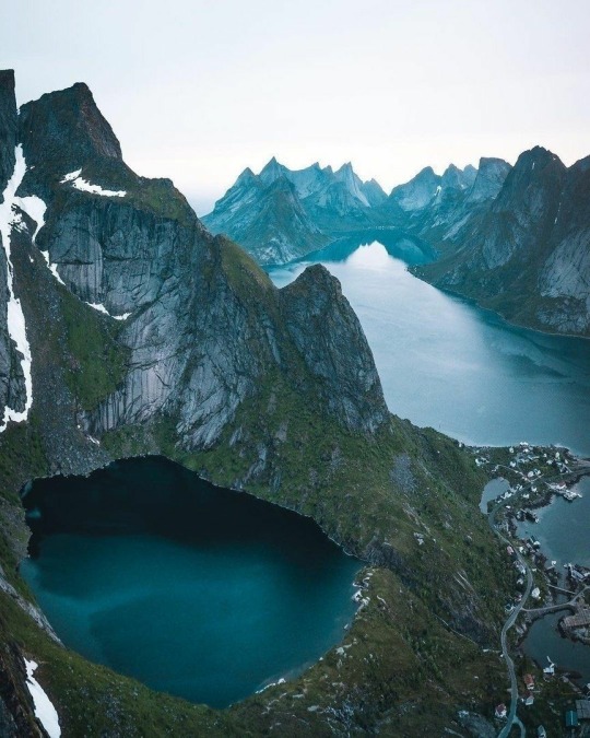
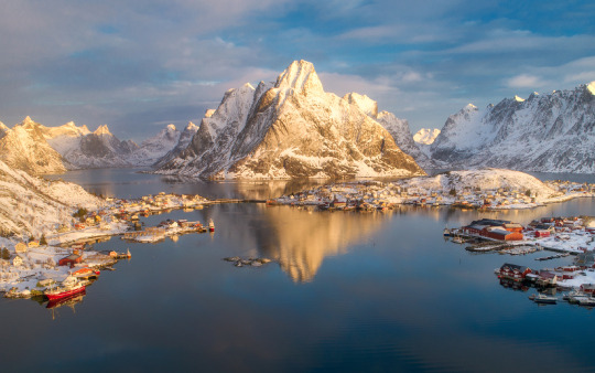
Лофотенские острова - живописный вид с горы Рейнебринген.
Рейнебринген - гора, возвышающаяся над деревней Рейне на юге Лофотенских островов. Именно отсюда сделано большинство «классических» панорамных фото Лофотенов с видами на архипелаг, рыбацкую гавань, горные озера, Рейнефьорд и живописный городок Рейне. Гора находится в муниципалитете Москенес к западу от Рейне, рядом с тоннелем Рамсвик.
Каменные склоны вершины Рейнебрингена изрезаны трещинами и уступами, которые создают удивительный рельеф и игру теней. Многие участки покрыты зеленым ковром из мха и невысокого кустарника. Со стороны залива и поселка Рейне гора кажется практически неприступной. Единственный более-менее «пологий» и пригодный для восхождения склон находится с западной стороны.
Рейнебринген имеет несколько пиков, и «панорамный» — не самый высокий из них. Финальная точка маршрута находится на относительно небольшой высоте 448 метров, но из-за крутого подъема восхождение не кажется легкой прогулкой. До недавнего времени власти коммуны Москенес не рекомендовали совершать тре��кинг из-за высокой опасности падения одиночных камней и схождения оползней. В июле 2019 года трек был официально открыт после завершения строительства каменной лестницы из 1560 ступеней. Совершать восхождение на Рейнебринген желательно в сухую и теплую погоду, поскольку в дождь ступени и верхняя тропа становятся скользкими, а при минусовой погоде камни обледеневают. Благоприятный сезон для посещения — с конца весны до начала осени. В это время в Норвегии не так дождливо, а непосредственно на Рейнебрингене — не так холодно и ветрено.Кроме того, с июня по август стоят белые ночи, поэтому треккинг не вызовет сложностей.
Lofoten Islands - a picturesque view from Mount Reinebringen.
Reinebringen is a mountain towering above the village of Reine in the south of the Lofoten Islands. It is from here that most of the "classic" panoramic photos of Lofoten are taken, with views of the archipelago, the fishing harbor, mountain lakes, Reinefjord and the picturesque town of Reine. The mountain is located in the municipality of Moskenes to the west of Reine, next to the Ramsvik tunnel.
The rocky slopes of Reinebringen are cut by cracks and ledges, which create an amazing relief and play of shadows. Many areas are covered with a green carpet of moss and low bushes. From the side of the bay and the village of Reine, the mountain seems almost inaccessible. The only more or less "gentle" and suitable for climbing slope is on the western side.
Reinebringen has several peaks, and the “panoramic” one is not the highest of them. The final point of the route is at a relatively low altitude of 448 meters, but the steep climb does not make the ascent seem like an easy walk. Until recently, the authorities of the Moskenes commune did not recommend trekking due to the high risk of falling single stones and landslides. In July 2019, the track was officially opened after the construction of a stone staircase of 1,560 steps was completed. It is advisable to climb Reinebringen in dry and warm weather, since in the rain the steps and the upper path become slippery, and in subzero weather the stones freeze. The favorable season for visiting is from late spring to early autumn. At this time in Norway it is not so rainy, and directly on Reinebringen it is not so cold and windy. In addition, from June to August there are white nights, so trekking will not cause difficulties.
Источник://dzen.ru/a/YRkA25DH4geKHRpb, //inafarawayland.com/ wp-content/uploads/2024 /05 / Reinebringen-21-683x1024.jpg, /pikabu.ru/story/c_reynebringen_otkryivaetsya_odin_iz_samyikh_zakhvatyivayushchikh_vidov_na_lofotenskie_ostrova_6625062, //www.tourister.ru/world/europe/norway/city/reine/mount/34950.
#Norway#Lofoten Islands#Reine village#Reinefjord#nature aesthetic#landscape photography#Mount Reinebringen#nature#lake#archipelago#moss#sky#fog#fishing harbor#nature video#Норвегия#Пейзаж#Лофотенские острова#деревня Рейне#Рейнефьорд#Рейнебринген#природа#архипелаг#горы#мох#небо#туман#озеро#рыбацкая гавань#видео
56 notes
·
View notes
Text

Red moon over the lake 🌕
#art#my art#pixel aesthetic#pixel graphics#pixel illustration#pixel artists#pixel artwork#pixel art#pixelated#cute pixel art#lake#red moon#water#trees#houses#reflections#moon#moon art#sky#landscape art#landscape#digital illustration#digital sketch#digital drawing#digital painting#digital art
61 notes
·
View notes
Text

Aaron Jenkin Photography
#landscape#photography#nature#travel#travelphotography#aesthetic#scenery#landscapephotography#landscape photography#sky#clouds#naturephotography#nature photography#photographers on tumblr#winter#forest#snow#mist#fog#foggy#misty#snowy#winterwonderland#new zealand#mountains#lake
51 notes
·
View notes


